Geoff Edwards
The late Ray Specht delivered the Romeo Lahey lecture in 1978 on behalf of the National Parks Association of Queensland. Titled In Wildness is the Preservation of the World, it offers a clear insight into Prof Specht’s scholarship as well as some thoroughly modern lessons about the value of wild places.
Related Images:

Principles of Botany for Queensland Farmers, C.T. White Government Botanist, 1938, published by the Department of Agriculture and Stock. (79 MB).
Related Images:
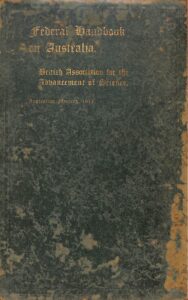
This remarkable book was produced by the British Association for the Advancement of Science in preparation for its “Australian Meeting 1914”. Not least of its remarkable features is a reference to The Royal Society of Queensland – on page 596, in the fifth volume – including a record of the number of members and the number of books in its library!
QSN has arranged scanning of the book and has uploaded it in five files because of their size. all have been rendered “searchable” though the search function is imperfect.
Federal Handbook A, pages i-209 – History, Aboriginals, Geology, Climate, Vegetation – 61 MB.
Federal Handbook B, pages 210-390 – Geology, Astronomy, Geodesy – 47 MB.
Federal Handbook C, pages 391-462 – Pastoral, Agricultural, Mining – 19 MB.
Federal Handbook D, pages 463-508 – Commercial – 16 MB.
Federal Handbook E, pages 509-598 – Education, Political, Miscellaneous – 32 MB.
Related Images:
The Australian Coral Reef Society (ACRS) conference is in Townsville this year from Tues 16 to Fri 19 September and they are seeking ideas for thematic symposia, workshops and field trips.
QSN member body Reef Ecologic is contemplating 2-3 field trips – a one day trip to John Brewer Reef (Museum of Underwater Art) and/or a one day trip to Yongala shipwreck and a multi-day (3 day) trip to Ellison Reef/Mission Beach after the conference. There will also be planned trips to Magnetic island (probably half day).
Thematic symposia, workshops and field trips
ACRS is seeking submissions for thematic symposia, workshops and field trips. Deadline 20 June 2025. ACRS is open to submissions of two kinds:
1) Thematic symposia. Participants are invited to submit proposals for themed sessions (i.e., groups of talks with a particular focus, which may be theoretical, problem-oriented, or relating to the practice of science). Proposals should include a title, names and contact details of lead organisers, a short explanation of the goals of the symposium, and provisional speakers and talk titles. Each symposium is expected to last roughly two hours, providing space for up to eight 15-minute presentations or six 20-minute presentations. Novel formats, such as discussion groups or panels (or a mix of presentations and discussions), are welcome.
2) Meeting-associated workshops and field trips. Participants are invited to submit proposals for any ancillary workshops or field trips that they would like to organise under the banner of the meeting. Past years have, for example, included training in coral identification; and sessions aimed at skill-building for student members. These proposals should include the names of the organisers, a brief summary of goals and planned activities, and an estimate of the number of individuals involved and the kind(s) of space that will be needed.
Related Images:
See this calendar of events on turtles, hammerhead sharks, crocodiles and climate change and invertebrates or Moreton Bay. First one Sunday 4 May.
Related Images:
Enviroed.com.au is an educational portal for people interested in learn about the environment, focusing on South East Queensland including Moreton Bay and the Moreton Bay Region. The purpose is to highlight the value of online education for raising the appreciation of our natural world. This portal is under construction.
Related Images:

Saltmarshes are vital intertidal ecosystems typically found between mangrove forests and dry land. These areas experience tidal flooding during king and spring tides. They support a diverse array of vegetation, including grasses and sedges, low shrubs, succulents, algae, and salt flats.
Dr Bob Crudgington, Director, EnviroEd and Manic Multimedia, has generously agreed to make available some educational materials on the ecology of salt marshes.
Two-page fact sheet – About Saltmarsh Ecology in Moreton Bay.
More to come.
Related Images:
At the time of drafting this post (April 2025), there seems to be no end of distressing news about loss of scientific knowledge, disbandment of scientific institutions and abandonment of knowledge-generating projects. So QSN has decided to open a page to accommodate some benchmark writings on the subject.
Two landmark documents in this field were published in the Proceedings of The Royal Society of Queensland in volume 124 of 2020:
Creating and then abolishing bodies of scientific knowledge, expertise and analytical capability: An Australian political malaise, by the late David Marlow, a member of the Royal Society of Queensland at the time.
Processes and institutions for scientific independence – Reflections on Land & Water Australia, by Jason Alexandra, highlighting the appalling decision to destroy one of the few national bodies aiming to reach across disciplinary boundaries to produce integrated analysis.
Society member Dr Geoff Edwards has written a few articles on the importance of knowledge in the series of opinion pieces Prevention or Patch-up? as contributions to a project by the Royal Societies of Australia on preventative health. Look especially for the first article on 28 February 2024; and the article “Prevention or patch-up? Data, information, and knowledge are not ‘wisdom’”on 8 May 2024; and on 1 May 2025 a critique of the political platform that would see large numbers cut from the Australian Public Service.
An opinion piece was published in the Times Higher Education on 24 April by Rhodri Davies and Dorrit Jacob:
“Earth science is critical to national resilience – so why is it being gutted? Australia must fund its universities in ways that reflect their mission – not just their margins”.
Related Images:
This ~225 page proceedings of a symposium held by the Water Research Foundation of Australia (South Australian State Committee) and the Department of Adult Education at the University of Adelaide on 23-25 February 1972 is described as the 40th in a series of publications of the Foundation. Published May 1973.
In an appendix, there is a description of the Constitution of the Foundation, which was established in 1955.
Related Images:

Two “Final Reports” about this project are available.
The report dated April 2016 commences thus: “The NRM Spatial Hub (the Hub) gives rangeland managers the capability to map, plan, analyse and monitor their properties infrastructure, land resources and ground cover to improve pastoral and natural resource management. The world-first technology underpinning the Hub will contribute significantly to the profitable and sustainable management of Australia’s rangelands. The Hub combines the latest cloud computing and geospatial mapping technologies with world-leading time-series satellite remote sensing, in a way that’s not been available to individual landholders before. For the first time, pastoralists can use and compare their data with government data in a secure, consistent and interactive way.
Users can now analyse and report on seasonal trends in ground cover within a paddock or across their entire property in less than 30 seconds. This is an Australian first and has been acknowledged by members of the global scientific community as a breakthrough in sustainable agriculture.
Due to the rapid development of the Hub infrastructure and the high level of interest shown by the grazing community, comprehensive demonstration of the technology was completed on more than 100 properties by late 2015, and more than 300 properties covering an area of more than 50 million hectares were using the system at the completion of this report in April 2016.”
At April 2025, the Hub’s website had closed down. Funding of one of its auspicing bodies the CRC for Spatial Information ended at 10 June 2018. The CRC’s resources library includes only a flyer about the project. QSN has uncovered a different flyer as well.
The Queensland Department of Agriculture and Fisheries produced a different report INNOV-068-SISR-DAFF dated March 2016 authored by Giselle Whish et al.
The Meat and Livestock Australia website reports that after the completion of Stage I, a Stage 2 commenced, on 1 May 2016 and ended on 20 June 2017. The intention was primarily to transition to commercial funding away from government funding:
“This short term project was to continue to develop the NRM Spatial Hub as a service to adequately support existing grazing enterprises, NRM organisations and industry service providers during the term of the project.
Stage 1 of the initiative has been a success (Federal Government development and then ERM.0098).
The challenge is to transition to a delivery model which supplies a self-sustaining business that continues to foster collaboration, and provide long-term opportunities for industry growth and efficiency gains across government and regional bodies.
This Stage 2 project (managed by AWI with funding via MLA, AWI, CRC SI, and Fitzroy Basin NRM ) of the NRM Hub aimed to:
- consolidate the service for 350 properties currently using the Hub; Achieved
- extend the Hub services to new properties and new “champions” in southern grazing systems; Achieved
- The Hub team conducted user training across Qld, NSW, VIC and SA, and a number of webinar sessions for WA and TAS users. Over the last 12 months over 400 producers and extension staff have completed NRM Hub training in the last 12 months, excluding training undertaken by other extension staff.
- embed the Hub in existing extension and research programs; Not fully progressed.
- interact with NRM regional bodies; Achieved NRM Extension staff allocated to properties on request. Over 80 Extension staff are routinely using the Hub in support of programs. Around a third of these are intensive users, who are also training properties owners in the Hub’s use.
- to scope best practice extension and NRM use case development and transition the Hub into a sustainable and on-going business model. Achieved Draft Commercialisation Report delivered.”
In mid-2017 the Hub moved to an “operational platform” and was renamed FarmMap4D.